Diriyah Development
YAZ’s role: 3D laser scanning and digital documentation of historic buildings: heritage reality capture and point cloud documentation of existing conditions.
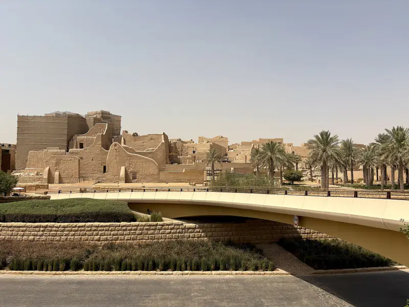
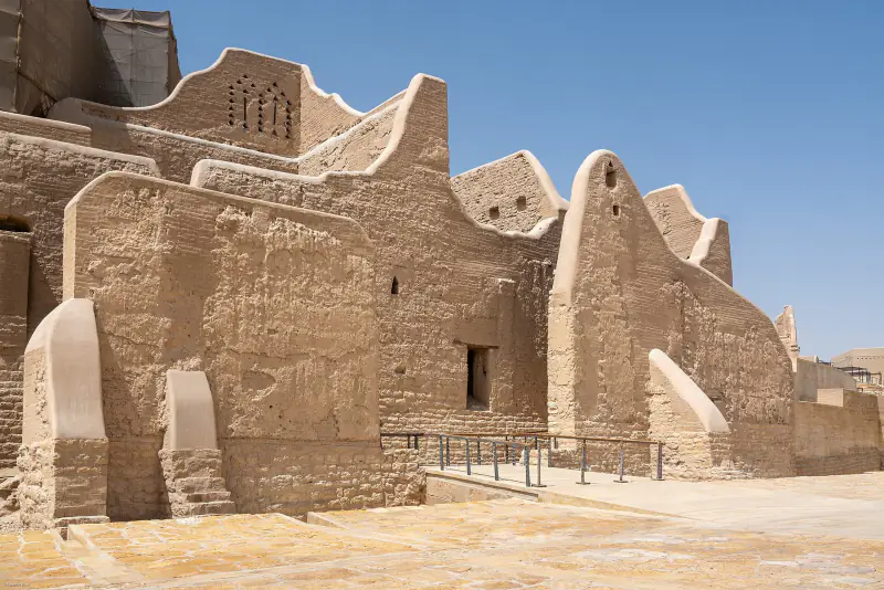
YAZ’s Contribution in Diriyah
Heritage Documentation and Existing-Conditions Capture
YAZ Development for Surveying & Contracting carried out 3D laser scanning of historic buildings in Diriyah, capturing existing conditions to provide a detailed geometric reference for engineering review and heritage-related project activities.
Historic buildings often contain irregular surfaces, complex spatial relationships and features that are difficult to document using conventional measurements alone. Laser scanning records this geometry as a three-dimensional point cloud, allowing project teams to examine the actual building configuration and take measurements from the captured data.
Capturing Historic Building Geometry
YAZ’s scanning work focused on documenting accessible building elements within the agreed survey areas, recording their form, dimensions and spatial relationships.
This approach provides a measurable record of existing conditions, helping project teams understand the relationship between walls, openings, façades and internal spaces wherever captured.
Supporting Restoration and Rehabilitation Planning
Existing-conditions documentation provides an important reference when planning work on historic buildings. Laser scan data can support the review of available drawings, assessment of building geometry and coordination of proposed interventions with existing fabric.
The captured information can also serve as a reference for producing plans, elevations, sections and other technical documentation, according to the agreed downstream scope.
A Digital Record of Existing Conditions
A point cloud preserves the geometry visible at the time of scanning. It enables project teams to revisit captured areas digitally, extract additional measurements and review spatial details without relying solely on photographs or isolated site measurements.
YAZ’s involvement in Diriyah demonstrates its experience applying 3D laser scanning to heritage environments, extending its reality capture capabilities beyond modern construction to the documentation of historic buildings.
Heritage Surveying and Reality Capture Services
YAZ provides 3D laser scanning and existing-conditions documentation for historic buildings, renovation projects and complex architectural environments. Survey coverage, required detail, control requirements and deliverables are defined to suit each project.
Need a measurable digital record of a historic building?
Contact YAZ to discuss your site, documentation requirements and intended use of the survey data.
Services on this project
Common questions
What was YAZ’s surveying scope on Diriyah Development?
YAZ’s scope on Diriyah Development: 3D laser scanning and digital documentation of historic buildings: heritage reality capture and point cloud documentation of existing conditions.
Which surveying services did YAZ provide on Diriyah Development?
3D Laser Scanning, Heritage Building Documentation, Reality Capture, Point Cloud Processing, Existing-Conditions Surveys.
Does YAZ do this kind of work on other projects?
Yes. The same surveying work is available for construction and infrastructure projects in Riyadh and across Saudi Arabia. Send your scope, location and start date through the quotation form or WhatsApp.
Other projects
Need Professional Surveying Teams or Geospatial Engineering Services?
Message us on WhatsApp or call +966 50 298 0251